GPS System Design
We are happy to show our company
GPS System Design Services
The Global Positioning System (GPS) is a radio frequency navigation system using satellites and is developed and operated by the U.S. Department of Defense. GPS consists of 24 satellites which orbit the earth twice a day (with the speed of 11,000 km an hour, approximately) and each has about 20,000 km distance from the earth. The system was originally developed for U.S. military applications in the 1970’s, but the U.S. government made it available for civilian use in 1980’s. In recent decades more countries including Russia, and China, and Europe have also developed satellite navigation systems or developing and contributing to the global and or regional satellite GPS. GPS signals are available all the time but can be obstructed and weakened with some obstacles such as mountains or buildings.
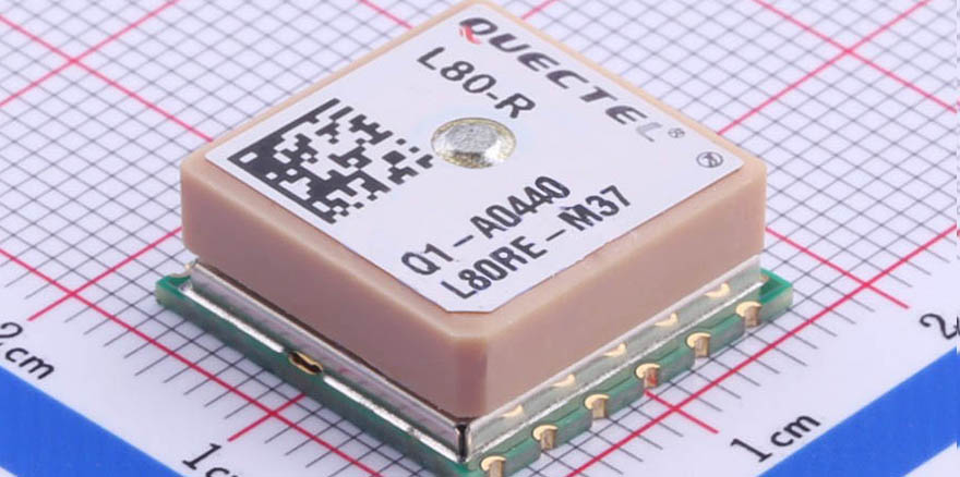
GPS Chipsets
The following chipsets have been in various devices designed and manufactured by Gambit Technology:
- Adafruit PA6H1F1702
- Sierra-Wireless XM1100
- Quectel L80
How Typical GPS Chipset Works
GPS user receives signal and uses the information to calculate the exact location of user by using triangulation method. GPS receivers can calculate Position, Velocity, and Time (in UTC) depending on the number of satellites they are locked on. GPS user computes the distance of satellite by comparing the time when signal was transmitted with the time when it was received. Position provides Latitude, Longitude, and Height of satellite.
In order to calculate latitude and longitude (2D position), GPS receivers need to be locked on to at least three satellites. GPS receiver can further compute user altitude if it’s locked on to four more satellites. GPS satellites are running by solar energy and they have backup batteries to keep them powered in the event of power outage such as solar eclipse.
Data logging
In some applications GPS data is collected and is sent to cloud servers for further user accessibility. Then, users can track any GPS equipped device in real-time using provided apps or websites. Gambit Technology used Amazon AWS in some applications to store GPS data on the cloud and make it available for end users.
Communication to the server in cloud
In some applications GPS data is collected and is sent to cloud servers for further user accessibility. Then, users can track any GPS equipped device in real-time using provided apps or websites. Gambit Technology used Amazon AWS in some applications to store GPS data on the cloud and make it available for end users.
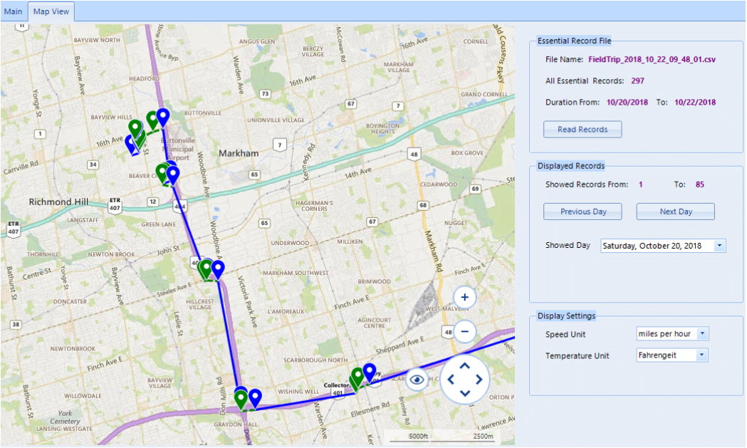
Data interpretation and live tracking on a map
Figure 1 illustrates a sample GPS live tracking application developed by Gambit Technology for a client. As shown, it’s easy to track where a device (in this case GPS device is in a car) is moving on the map. Some other options have been also added to sort or filter time of tracking or change desired settings.